

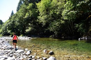
• Canyon Creek is a large swimming area with sand and pebble beach
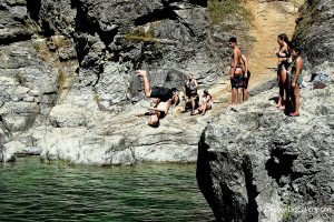
• Rock jumping opportunities
Due to wildfires, the park is closed


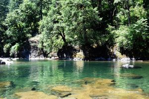
Surrounded by an old-growth forest, Canyon Creek Recreation Site is a beautiful place where you could easily spend an entire day.
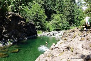
Managed by BLM, Canyon Creek offers picnicking, camping, swimming and jumping opportunities. A big open swimming area on a bend of the Little North Fork of the Santiam River with a slow river current, broad sandy and pebble beach make this destination a popular spot on a hot summer day.
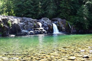
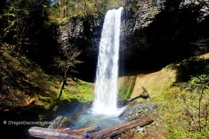
A big rock across the river is used for jumping. Small rapids upstream that connect a few small pools feed the bigger pool and can be used by kids for the natural water slides. Canyon Creek also features a small waterfall on the opposite side of the river.
There are a few picnic sites, a hand pump for potable water, and a restroom.
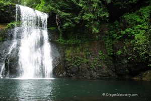
There are many other swimming and picnicking places within Little North Santiam Recreation Area including North Fork County Park, Bear Creek County Park, Elkhorn Valley Recreation Site, Salmon Falls County Park, and the Opal Creek Wilderness oasis - Three Pools Recreation Area.
Canyon Creek | General Description
Open: May - September from dawn to dusk
Managed by: BLM
Location: Little North Santiam Recreation Area
Services: Vault toilets, potable water, garbage service, picnic sites
Activities: Swimming, rock jumping, fishing, hiking
Distance from the parking: Short
Road access: Any passenger vehicle
Day-use fees: Yes or Interagency Senior/Access/Military Pass
Dogs: Must be on a leash
Popularity: Moderate to high
Accommodations: Elkhorn Valley Campsite
Affordable vacation rentals for short and long term stay at Salem
Elevation: 1,000 ft (305 m)
Canyon Creek is located:
- 9.3 miles east of Lyons
- 33 miles east of Salem
- 78 miles southeast of Portland
- 81 miles northeast of Eugene.
Swimming hole rating: 4 out of 5
Body of Water: River
Water quality: Transparent
Current (summer): Light to Moderate
Depth: Deep and shallow
Beach: Sand and river rocks
Water T° (summer): Cool
Aventures Nearby
Directions
From Salem,
- Drive approximately 24 miles east on State Highway 22 to N Fork Road/Little North Fork
- Turn left onto North Fork County Road
- Continue 7.3 miles to your destination on the left.
Phone: 503-897-2406
BLM